20.37.410 Waterfront district urban village – Establishment of boundaries and land use areas.
A. The boundaries of the waterfront district and associated land use areas are delineated in Figure 20.37.410-A.
B. The waterfront district is divided into various commercial and industrial land use areas. The purpose of these areas is to encourage the clustering of compatible uses, establish areas of unique character, and allow for variance in design and development intensity.
1. Generally. The waterfront district mixed-use designation is intended to implement the waterfront district subarea plan and community vision for the central waterfront. The mix of land uses and densities is intended to attract a compatible mix of commercial, institutional, light industrial, recreational, and urban density residential land uses. Parks, trails, public gathering places and areas for public use and enjoyment of the waterfront are encouraged throughout the district. Development and design standards encourage pedestrian-oriented development at street level and preserve water views from public viewpoints within adjacent neighborhoods through the use of view corridors and building height limitations.
2. Industrial Mixed-Use (IND). The waterfront district industrial mixed-use designation recognizes the value and unique character of property with access or close proximity to navigable water and reserves this property primarily for industrial uses which depend upon or relate to the waterfront, but also allows public facilities, services, commercial and light industrial uses which support or are compatible with an industrial setting in areas where infrastructure supports such uses. Development regulations in this area allow the building height and bulk needed to accommodate marine and industrial uses.
3. Commercial Mixed-Use (CM). The waterfront district commercial mixed-use designation is characterized by a mix of residential, commercial, institutional, offices, recreation and public uses. Eating, drinking, entertainment, retail and service establishments are encouraged at ground level.
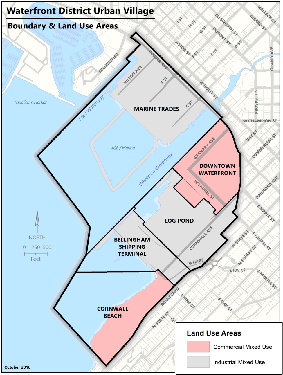
Figure 20.37.410-A Waterfront District Urban Village Boundary and Land Use Areas
[Ord. 2019-12-040 §§ 11, 12; Ord. 2013-12-090 § 10 (Exh. F)].